On a map of the Maya lowlands, a small rise may be the surviving mass of an ancient building. It may also be a natural formation. Lidar makes the shape of the ground easier to examine beneath vegetation; artificial intelligence can help select shapes that deserve a closer archaeological look.
The distinction matters. A detected mound supplies a place to investigate. Establishing when people built there, what they used the building for and how it related to neighbouring settlements requires further evidence. The promise is a more informed search across a landscape whose human history is only partly visible.
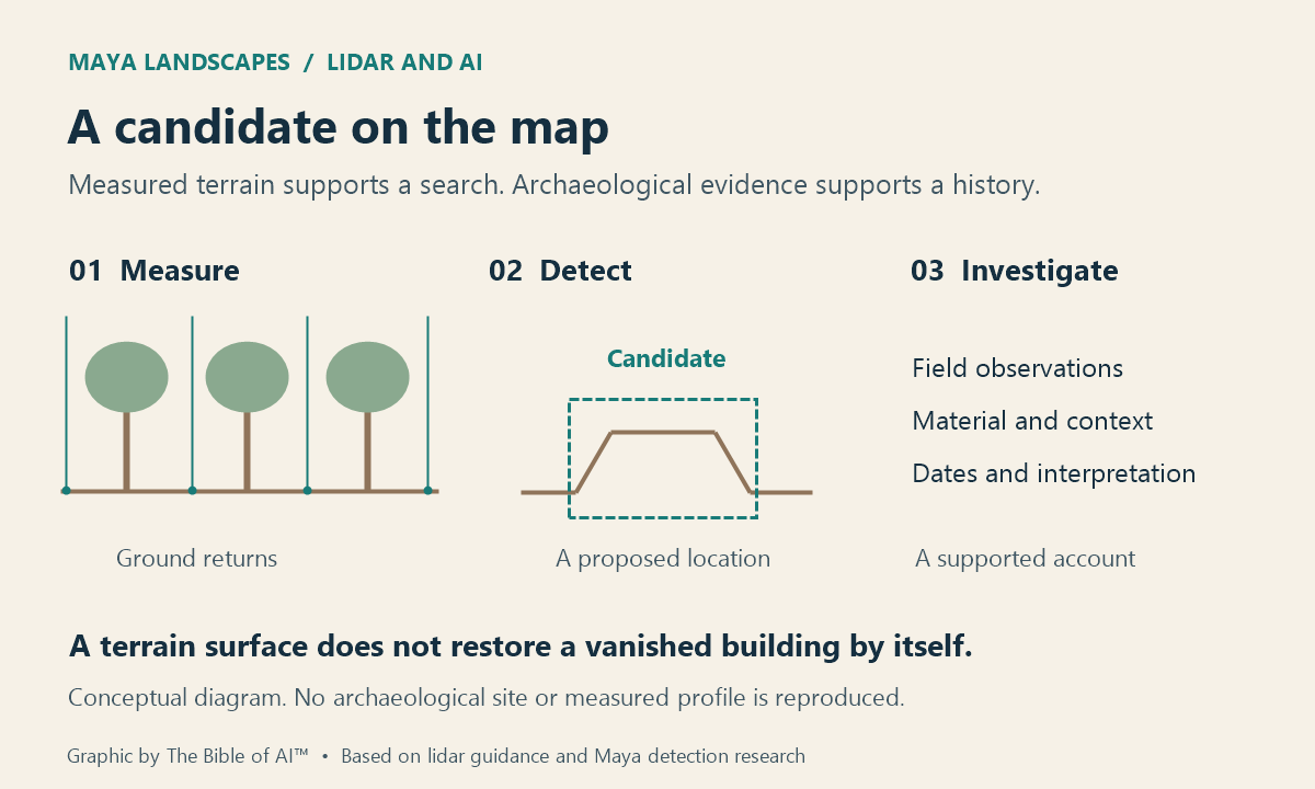
From laser returns to archaeological candidates
Airborne lidar measures distances with laser pulses. Some reach the ground through openings in the vegetation; others return from leaves and branches. Processing separates likely ground measurements to construct a terrain model. As NOAA’s lidar guide explains, dense vegetation can leave too few ground observations. The method depends on openings and sampling, so the resulting surface is not equally reliable everywhere.
AI can then examine images derived from that terrain. A 2024 study in the Journal of Archaeological Science trained an object detector using 15,765 labelled Maya mounds from areas in Guatemala. Combining examples from different areas improved performance compared with training on one area alone. The researchers also found that the chosen way of displaying local relief affected detection: preparing the terrain image was part of the scientific method.
A subsequent Q2000 study, published online in November 2025 and assigned to a 2026 volume, used NASA G-LiHT data from two regions of the Yucatan Peninsula. Its 2,000 selected training examples supported a detector intended to work across varied settings. The flight transects actually examined totalled 421 km²; they sampled a much larger regional extent.
The study reports an F1 score of 0.89, combining precision and recall. Its evaluation used curated, visually assessed test cells and combined counts of individual detections with counts of cells. This is not evidence that 89% of all Maya buildings have been found, and the score should not be ranked directly against results from different evaluation designs. Training and test identifications were not comprehensively confirmed through physical field inspection, and the authors acknowledge possible human identification bias.
When does a terrain model become a reconstruction?
A detector marks candidate locations in the surviving landscape. The terrain surface alone cannot recover the vanished roof of a house, date its construction or establish the activities of its occupants. A convincing reconstruction has to connect measured remains with excavation records, architectural evidence and clearly stated interpretations.
The MayaArch3D project at Copán illustrates a complementary approach. Its research environment connects three-dimensional models with archaeological records and geographic information, allowing architecture and landscape to be examined together. Laser scanning and photogrammetry contribute models of surviving objects and buildings. This project supplies a useful example of linking geometry to evidence; it is separate from the AI detectors described above.
For a reader exploring a reconstructed settlement, the key question is what supports each visible element. A measured platform, a proposed building outline and a reconstructed upper storey carry different kinds of evidence. Showing those distinctions makes a three-dimensional view useful for inquiry, because a change in interpretation can be traced back to the observations behind it.
Lidar and AI can help archaeologists identify where to look and compare patterns across difficult terrain. The larger historical task is to establish which of those patterns belong to human activity, how they developed over time, and what remains uncertain when the past is made visible again.
Liked this post? Follow this blog to get more.