Picture yourself on a winding path across the Nazca Pampa in southern Peru. A figure barely visible from where you stand may be easier to notice from an aeroplane. Yet the camera brings its own difficulty. It photographs everything. Somewhere among patches of stony ground and shallow changes of colour is a shape worth walking out to inspect. Who decides where the field team spends its next day?
A collaboration between the Yamagata University Institute of Nasca and IBM Research tested a way to make that choice. In a six-month field survey the archaeologists documented 303 previously unrecorded figurative geoglyphs of the small relief type. The most revealing part of their paper in PNAS is the account they give of how each figure came to their attention.
Where to send a field team
The starting material was aerial photography. Software marked portions of photographs whose appearance resembled examples of known figures. Archaeologists screened 47,410 suggested boxes and retained 1,309 promising candidates. They visited 341 candidate locations during the survey. A box is an area on an image, a location is somewhere a team can visit, and a figure is an archaeological observation. The three counts measure different things. Dividing 303 by 341 would give a striking but misleading impression of the detector’s accuracy.
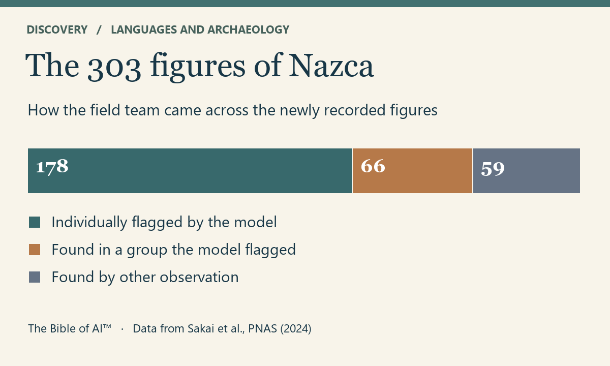
Of the 303 figures, the model had flagged 178 individually. Another 66 emerged when researchers examined groups to which the model had drawn attention. The other 59 came to light through field observation or inspection beyond the suggested boxes. Imagine a surveyor arriving to examine one shape and noticing a second beside it. The journey owes something to the software. The second observation owes something to a person willing to look beyond the rectangle. The authors’ accounting preserves both contributions.
What would a walker have seen?
The enlarged inventory changed the questions archaeologists could ask. Many small relief figures lay near old winding trails and depicted human figures or animals associated with people. The larger line figures showed a different distribution and more often represented wild animals. For a modern visitor the obvious viewpoint might be high above the desert. For the people who walked those paths the relevant view may have been a few steps ahead. The survey team’s illustrated account explains why motif, scale and distance from a trail belong in the same argument.
Proximity makes an interpretation possible. It does not tell us what a particular walker thought a figure meant. Nor does recording a figure establish its maker’s name or recover a sentence in a lost language. What the survey gives us is a stronger basis for asking who could see these images and under what circumstances. It also gives heritage specialists a better record of fragile features worth protecting. The physical ground remains the place where a promising mark becomes evidence.
Liked this post? Follow this blog to get more.